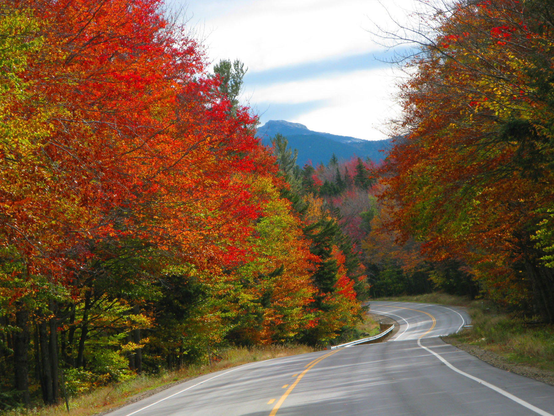
The Kancamagus Highway in New Hampshire reigns as one of the best fall foliage destinations in New England, or the United States, for that matter. Located about 60 miles north of Concord, N.H., and with a commanding elevation at about 3,000 ft. above sea level, the 34.5-mile Kancamagus Highway — otherwise known as Route 112 — is simply fabulous for car and motorcycle driving tours, as well as hiking and camping (more on that in a moment).
Q. When is the best time to see fall colors on the Kancamagus Highway?
A: Typically, leaves start changing in the middle of September with peak fall foliage during the first two weeks of October. Colors vary from year to year, though, so I recommend frequently checking the VisitNH web site fall foliage tracker.
Q: Any recommended scenic spots?
A: The whole Kancamagus Highway is virtually one continuous scenic wonderland. According to the U.S. Department of Agriculture Forest Service web page for the Kancamagus Highway, “Lower Falls is the most popular destination on the Kancamagus Highway. It is a beautiful spot where the Swift River drops many feet over smooth granite rocks into a large pool. It is an ideal place to picnic…” The Travel Channel recommends, “As you continue along the highway, ascending 2,860 feet up the Kancamagus Pass, to the highest point of the highway, stop to appreciate the views at various scenic lookouts. The Sugar Hill, Pemigewasset and Hancock overlooks make for nice photo ops, as well as Falls Pond and Rocky Gorge. Another scenic highlight is a short and easy hike of less than half a mile to see the picturesque Sabbaday Falls, a popular stop on the highway.”
We recommend watching this video for some more great suggestions…
Q: What are the closest and most interesting towns to stay near the Kancamagus Highway?
A: North Conway and Lincoln. Both have plenty of restaurants and shopping, particularly North Conway, which features a charming downtown, as well as outlet shopping, with great mountain views. Here, you can price compare and make reservations for hotels in North Conway and Lincoln. I recommend booking a room as soon as possible as you don’t want to find yourself in a “no vacancy” scenario when the peak season arrives.
Q: Are there any campgrounds around the Kancamagus Highway?
A: Yes, here are some;
Covered Bridge Campground
Blackberry Crossing Campground
Jigger Johnson Campground
Passaconaway Campground
Big Rock Campground
Hancock Campground
For more info on these campgrounds, please check out the excellent Kancamagus Highway web site.
Q: What can I get the latest weather reports for the Kancamagus Highway?
A: With the internet, you’ll find many resources but I personally like Weather.com.
Q: How are modern day conveniences along the Kancamagus?
A: Not good, and that’s a good thing as you want to be focused on the breathtaking scenery here. You’ll start to lose cell phone reception just a few minutes into the ride. There are no gas stations, convenience stores, restaurants and hotels. Plan accordingly and know that civilization exists in many towns just off both sides of the highway. Or, maybe this — the Kancamagus Highway — is civilization, and we have it all backwards?
Q: How much time should I allot to visit the Kancamagus?
A: If there’s lots of traffic, several hours to factor in the road congestion. If you are lucky and avoid the worst traffic, plan on spending two or three hours here to get, at the very least, a greater appreciation of the “Kanc.”
Q: How do I get to the Kancamagus Highway?
A: Here you go, courtesy of MapQuest…